Perhaps you've heard of this new thing called "the internet"? It's a global technology system that is used to spread, among other things, pornography and misinformation, as well as "memes" where people reinforce their own political and religious views, and here's an example.
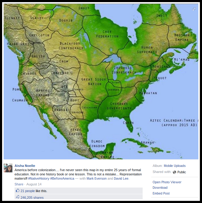
I'm not going to worry about the politics too much. They are, for better or worse, not too far from my own. But is the map correct? Is it a true and accurate representation of America before Columbus's arrival? --absolutely not!
The more one looks, the more problems one finds. What the heck is the "Apache Empire"? And how could such an entity exist when the Apaches lacked a centralized government?
The Aztecs are portrayed as having a huge empire, when books such as Aztec Warfare: Imperial Expansion and Political Control , by Ross Hassig (1995, University of Oklahoma Press) explain very clearly why they never had an empire this huge. (hint, logistics is tricky. Logistics without beasts of burden is even trickier.) And why in the world are the Aztecs and the Olmecs shown as co-existing at the same time?
As for the Iroquois Confederacy, although it is properly named, it stretches too far to the west.
So what the heck is this thing? And why is it dated 2015, another major tip off?
Noting these things, I went to snopes. ( Snopes ) They uncovered the source. A hobbyist of some kind decided to make an imaginary map of a North America that was never discovered by Europeans and this was the result. .
No comments:
Post a Comment